
Coastal location and transport reference
Locate the coastal provinces using the national port zoning map in the MPWT / JICA report of November 2025.
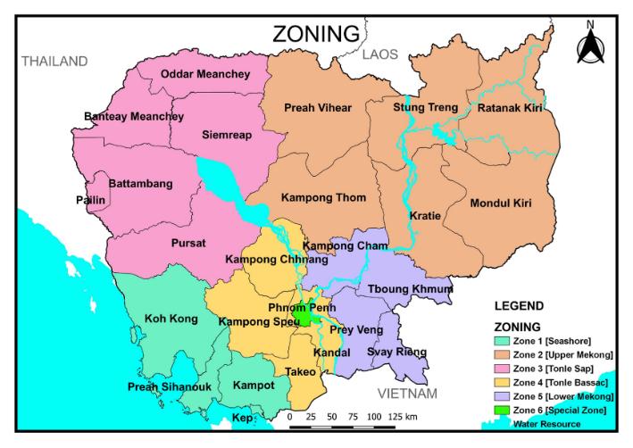
This is Figure (1) from the MPWT / JICA report on strengthening capacity for ports administration, dated November 2025.
Provincial labels, study zones and the original legend are retained as a location reference for the coastal provinces and Cambodia’s transport geography. Colours represent the report’s port study zones, not investment parcels, eligible investment areas or project approval status.
What the map shows
The figure shows port-study zones and helps explain regional relationships. It is not a navigation map, a current freight-service table, or a land-parcel or investment-offer map. Download the report volume from the resource page and open PDF page11 for the original Figure1. Assess a specific site using the full report, the actual route and facility operating information.
Check roads, rail and ports separately
Preah Sihanouk’s nodes include its deep-sea port, international airport and expressway to Phnom Penh. Southern rail services link Phnom Penh, Kampot and Sihanoukville; Kampot’s setting also involves National Road 3 and its port areas. Passenger fares and timetables are not freight quotations. Confirm cargo types, handling, last-mile haulage and available services with the operator.
Continue exploring
Read the port-zoning study volume (English PDF, Figure 1 on page 11)